Drone Software Development
Drones have evolved from hobbyist gadgets into critical tools for businesses and government, powered by sophisticated software that enables autonomous flight and data collection. The global drone software market is growing rapidly – it’s projected to increase from $5.1 billion in 2022 to $11.2 billion by 2027, a 17.1% annual growth rate driven by new applications in fields like agriculture and logistics. This surge reflects how essential software has become in unlocking drones’ potential across industries. In this post, we’ll dive deep into drone software development – exploring the core platforms and tools, the key features and capabilities, and real-world examples in logistics, defense, and agriculture.
Modern Drones Software
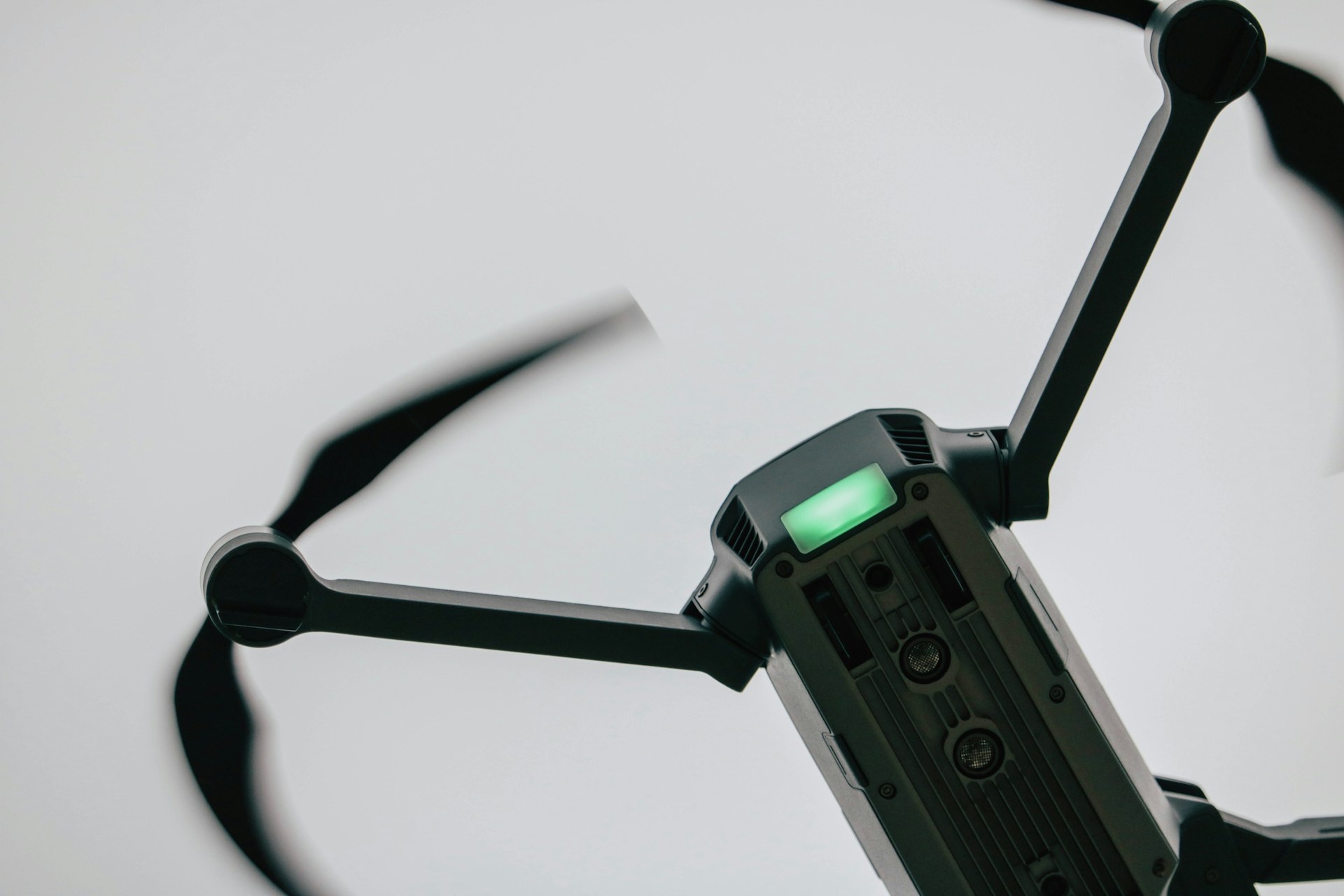
Drone software (often called autopilot software) is essentially the “brain” of an unmanned aerial vehicle. It’s a suite of programs that controls and manages the drone’s operations, from balancing the rotors to navigating GPS waypoints. In autonomous drones, the software carries out pre-programmed flight plans or interprets live commands from a remote pilot. Importantly, drone software isn’t a single monolithic program – it typically consists of onboard firmware for real-time flight control and offboard applications for mission planning, data processing, and user interface. Together, these software components enable a drone to fly safely, collect and transmit data, and even make intelligent decisions mid-flight.
Open-source platforms have been instrumental in drone software development. For example, the PX4 Autopilot is an open-source flight control stack that has become a standard across many drone types – it supports everything from small quadcopters to industrial UAVs. PX4 provides the low-level algorithms for stabilizing flight and a middleware to integrate sensors and actuators, all of which developers can customize for their specific hardware. Another widely used platform is ArduPilot, an open-source autopilot software originally born from the DIY drone community. ArduPilot is remarkably versatile, supporting not just multirotor drones but also fixed-wing aircraft, helicopters, ground rovers, and even submarines. These platforms give drone startups a proven foundation so they don’t have to reinvent flight control from scratch – instead, engineers can build on a reliable core and focus on higher-level features.
Beyond the flight control itself, drone software development involves many supporting tools and SDKs. Manufacturers like DJI and Parrot offer Software Development Kits that let programmers access drone features (camera, sensors, telemetry) from mobile or PC applications. For instance, DJI’s Mobile SDK allows developers to write custom apps for DJI drones, including capabilities like live video feed, flight telemetry, and even automated flight modes. There are also vendor-agnostic libraries such as DroneKit (Python), which works with ArduPilot to give a high-level API for drone commands. Many developers leverage communication protocols like MAVLink – a lightweight messaging protocol that standardizes how drones talk to ground control stations. MAVLink ensures that a drone’s onboard autopilot can seamlessly communicate with control apps or remote pilots, exchanging telemetry data and commands reliably. Using these tools and frameworks, a drone software stack typically includes an onboard real-time control loop, communication links, and ground-based or cloud software for mission planning and data analysis.
Capabilities of Drone Software
Modern drone software is packed with features that go far beyond basic remote control. Whether the drone is used for delivering packages or surveying farmland, certain core capabilities are essential for safe and effective operations:
Flight Control and Stability
At the heart of every drone is software that keeps it stable in the air. This includes attitude control, altitude hold, and precise maneuvering based on input from gyroscopes, accelerometers, and other sensors. A good autopilot can hover a drone in place or smoothly follow a trajectory with minimal drift. Stability algorithms and motor control loops run on an embedded processor to react in milliseconds if a gust of wind tries to tip the drone.
Navigation and Autonomous Modes
Drone software typically integrates GPS navigation to handle waypoint flight – enabling the drone to fly a predefined route or return to home automatically. Advanced drones also use computer vision or LiDAR for obstacle avoidance and terrain following. For example, software might create a 3D obstacle map to help the drone avoid collisions in real time. High-end systems include object recognition using AI, so a drone can identify and track objects or people on the ground. Some drones support swarm capabilities, where one software system can coordinate multiple drones to work together on a task – a feature relevant in military or large-scale industrial scenarios. Autonomous flight modes are all enabled by these intelligent navigation features.
Telemetry and Real-Time Data
A drone continuously generates data during flight – GPS coordinates, speed, altitude, battery status, camera feeds, and more. Drone software includes telemetry modules to transmit this data live to operators on the ground. A robust link lets a remote pilot or an automated system monitor the drone’s status and intervene if needed. Sensor data logging is also important; software records flight logs, which can be used for regulatory compliance or post-flight analysis. In applications like mapping or agriculture, drones capture high-resolution images or sensor readings, and the software may begin processing this data in-flight. For instance, some drones use edge AI to analyze photos on the fly, flagging areas of interest so that crucial information is available immediately.
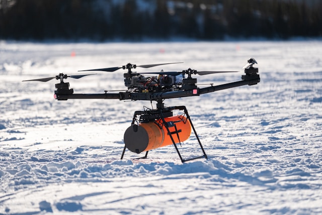
Payload and Camera Control
In many use cases, the drone’s value lies in the payload it carries – such as a camera, a thermal sensor, or a delivery mechanism. Drone software often provides an interface to control payloads. This can mean stabilizing a gimbal to keep a camera steady, adjusting camera parameters remotely, or controlling a release mechanism to drop a package. For example, a drone used in search-and-rescue might have software-controlled spotlights and infrared cameras that the operator can aim mid-flight. In aerial photography, software allows real-time camera views and shot framing on the controller screen. These features ensure the drone not only goes where it needs to, but also does the job it’s meant to do once it’s there.
Drone Software in Logistics and Delivery
One of the most headline-grabbing uses of drones is in logistics and package delivery. Companies like Amazon, Google (Wing), DHL, and UPS have all experimented with delivery drones to speed up shipments. Drones offer the promise of ultra-fast last-mile delivery and can reach places that ground vehicles might struggle with. In fact, during the COVID-19 pandemic, drones were effectively used to deliver millions of vaccine doses and medical supplies in areas with poor road access. Several countries in Africa and remote regions worldwide deployed drones to carry critical health supplies, proving the life-saving potential of this technology.
From a software perspective, logistics drones require robust mission planning and fleet management systems. Delivery drones must calculate optimal routes, avoid no-fly zones, account for weather, and often coordinate with centralized dispatch systems. Drone software for logistics includes platforms that let operators set delivery waypoints and monitor multiple drones in real time on a map. For example, enterprise platforms like Airware and FlytBase provided cloud-based drone fleet management, enabling businesses to plan missions and manage drone fleets through a web dashboard. Even more specialized, some drone companies integrate their software with e-commerce or supply chain systems – so that when an order comes in, a drone delivery mission can be automatically generated.
Crucial features for delivery drones include precise navigation and obstacle avoidance, since these UAVs might fly over urban areas or varied terrain. The software will typically enforce geofences around airports or sensitive locations, and integrate real-time airspace data to avoid other aircraft. Autonomous landing capability is another must-have: the drone’s software might use computer vision to recognize a landing marker or safe drop spot at the destination. For instance, a delivery drone could have a downward-facing camera and AI algorithm to identify a designated “drone mailbox” target on the ground. If the drop zone is clear, the software either lands the drone or drops the package from a low altitude using a tether or parachute. All of this is executed by onboard software with fail-safes – if conditions aren’t right, the drone can abort and return to base.
Logistics-focused drone software also has to handle fleet operations. A company might have dozens of drones in the air at once, so software coordinates scheduling, battery swapping, and flight approvals. According to industry reports, the rise of same-day delivery demand is indeed pushing many retailers and supply chain firms to invest in drone delivery platforms. Trials have shown promising results: for example, the U.S. Marine Corps tested a logistics drone that carried a 60-pound cargo over a distance of 100 km to resupply troops, demonstrating a reliable and efficient way to get supplies to hard-to-reach locations. In civilian logistics, the drone startup Matternet worked with hospitals in Switzerland to ferry lab samples between facilities, cutting transit time and operating on automated schedules. These real-world tests are powered by software that can manage repeatable, autonomous flights with high reliability.
It’s worth noting that regulatory compliance is a big part of drone delivery software. In many countries, autonomous beyond-line-of-sight delivery flights require special approval. Software can assist with compliance by recording flight logs and providing control handoff to human pilots when needed. For instance, an operator might supervise multiple delivery drones, ready to take manual control via software if any drone encounters an unexpected situation. Overall, drone software in logistics is all about efficiency and safety at scale – it optimizes routes, coordinates multiple vehicles, keeps flight operations safe, and integrates with the broader logistics workflow. As e-commerce and supply chains continue to embrace automation, drone software development tailored to delivery use-cases will only grow more important.
Drone Software in Defense and Security
Defense was one of the earliest adopters of drone technology, and it remains a driving force for cutting-edge drone software development. Military and security drones (often called UAVs or UAS in this context) range from small quadcopters used for platoon-level surveillance to large high-altitude drones for strategic reconnaissance. What they all share is a reliance on sophisticated software to fulfill their missions under demanding conditions. In defense, reliability, autonomy, and secure communications are paramount – lives can depend on a drone’s software performing flawlessly in the field.
Security and military drones often operate beyond visual line of sight and in hostile environments, so their software emphasizes robust autonomous capabilities. For example, drones used for battlefield reconnaissance might have software that allows them to navigate terrain at low altitude and avoid obstacles or enemy detection without constant remote piloting. The adoption of drones for both commercial and defense applications has in fact driven the development of very efficient fleet management and autonomy software, enabling one operator to manage many drones and to carry out long-range missions safely. A key feature here is redundancy and fail-safe logic – military drone software is usually built with backup systems and the ability to handle partial failures and still complete the mission or at least return to base.
Secure and encrypted communication is another critical aspect. Defense drones often use proprietary data links with encryption; the software ensures that control commands and video feeds cannot be intercepted or spoofed by adversaries. There are also cybersecurity frameworks in place – for instance, authentication routines in the software so only authorized users can control the drone or access its data. In recent years, the concept of drone swarms has emerged in defense: swarms involve many drones cooperating as a single unit, which requires a completely new level of software sophistication. Rather than one pilot per drone, swarm software lets a single operator send high-level commands to dozens of drones, which then coordinate among themselves using AI algorithms. A dramatic example is a program unveiled by the Swedish Armed Forces in 2025 – it features software that allows a soldier to control up to 100 drones simultaneously for surveillance, defense, or even coordinated payload delivery tasks. This cutting-edge system is tested to autonomously adapt the drones’ behavior in a group, showing how far drone software in defense has come.
Even outside of swarms, defense-oriented drone software pushes the envelope in autonomy. Drones may use onboard machine learning to identify targets in real time and flag them for human analysts. They also often integrate with larger command-and-control (C2) systems. For instance, a surveillance drone’s software might feed live imagery into a military’s battlefield management software, essentially acting as an eye in the sky that seamlessly joins a network of other sensors. This requires strong APIs and data standards – a role that software plays to encode video, metadata like coordinates, and transmit it over secure networks to command centers. An example from the U.S. is the use of the MAVLink protocol being adapted and extended for some military UAS to ensure interoperability between drones and ground stations.
On the security and policing side, drone software is used for tasks like border patrol, crowd monitoring, or search-and-rescue. These scenarios require real-time video streaming, often to more than one viewer, so the software employs streaming codecs and may even do onboard video summarization. Law enforcement drones might run specialized software for facial recognition or license plate reading – though such uses raise privacy questions, technically the capability can be there. Importantly, many defense/security drones are built to fail safe: if they lose connection or encounter jamming, the software might trigger an automated return home or self-landing routine to prevent flyaways or capture by adversaries.
In summary, drone software in defense and security focuses on autonomy, multi-drone coordination, and hardened reliability. From enabling complex swarm maneuvers to securing every byte of data in transit, the software is what differentiates a basic remote-controlled aircraft from a smart, battlefield-ready drone. These innovations often trickle down – features like obstacle avoidance, redundancy, and encryption that were pioneered for military drones are now becoming standard in enterprise drone software as well.
Drone Software in Agriculture
Agriculture has emerged as one of the most impactful domains for drone deployment. Agricultural drones are used for everything from surveying large fields to precision spraying of crops, and they rely on software to turn raw aerial data into actionable insights for farmers. In essence, drone software is helping to make farming more data-driven and efficient – a concept known as precision agriculture. By equipping drones with multispectral cameras and sensors, and analyzing that data via software, farmers can monitor crop health, optimize irrigation, target pesticide use, and much more.
A key role of software in agri-drones is mapping and analytics. Drones can capture high-resolution images of farmland; the software then stitches these images into an orthomosaic map and applies algorithms to detect patterns. For example, an agriculture drone software might generate an NDVI (Normalized Difference Vegetation Index) map from multispectral imagery to highlight which areas of a field have healthy vegetation versus which are stressed. These kinds of insights allow a farmer to intervene early – and they’re made possible by advanced image processing and AI routines in the drone or cloud software. Real-time data processing is increasingly important: some drones can process sensor data on the fly to provide immediate indicators of crop health. As a result, a farmer could literally see a live map of their field’s condition right after the drone passes over, which speeds up decision-making.
Agriculture drone software also excels at automated flight planning. Covering a large field in a systematic way needs carefully planned flight paths – typically a lawnmower-like grid pattern at a fixed altitude. Software applications like DroneDeploy and Pix4D have become popular in farming because they allow users to draw a boundary of a field on a map, then automatically generate the optimal flight path for the drone to survey that area. The drone will autonomously fly the route, maintaining overlap in the images for complete coverage, all controlled by the onboard autopilot following the plan uploaded from the software. In crop-spraying, software ensures uniform coverage: for instance, a drone carrying fertilizer or pesticide can have its path and speed precisely controlled to apply an even spray, and the software can adjust for wind drift or varying terrain height.
What truly sets agriculture drone software apart is the domain-specific analysis it provides. Farmers don’t just need raw images – they need to know what those images mean for their crops. Many agriculture-focused drone applications come with built-in analytics to detect issues like pest infestations, irrigation problems, or nutrient deficiencies. Some use AI models trained on agricultural datasets to classify crops and even predict yields. For example, an advanced agriculture drone platform might automatically count plants in an orchard from drone images or measure crop canopy cover percentage over time. By integrating these analytics, the software turns drone-collected data into practical recommendations (e.g., “Section C needs more nitrogen” or “watch out for possible disease in the north field”). As one tech blogger noted, drones equipped with the right software give real-time insights into crop health, soil conditions, and irrigation requirements, letting farmers make informed decisions quickly.
Several software tools have made names for themselves in this sector. We’ve mentioned DroneDeploy and Pix4D (which are used for mapping and have agriculture-specific modules), and there’s also Agremo, which focuses on agronomic analysis like plant counting and health monitoring. Many drone solution providers offer end-to-end agriculture packages: a drone plus software that’s tailored for specific crops. For example, one package might be tuned for vineyards – using thermal cameras and software that can predict grape yield and detect vine stress. Another might be for large grain farms – using multispectral imaging and offering integration with farm management systems. Notably, custom software development is on the rise here too, as larger agricultural enterprises want solutions tailored to their own operations. Custom drone software can integrate with tractors, combine harvester data, or irrigation systems, fitting into the IoT ecosystem on modern smart farms.
In practical terms, the benefits of drone software in agriculture include higher crop yields and lower input costs. By spotting issues early and treating only the areas that need attention, farmers save on fertilizer, water, and chemicals. It’s more environmentally friendly and profitable. A simple example: a drone survey might reveal that only 30% of a field has pest damage, so instead of spraying the entire field, the farmer can target just that 30% – saving chemicals and avoiding unnecessary plant stress. Without the software analyzing the drone’s aerial data, pinpointing that would be much harder. This is why observers say drones are revolutionizing agriculture by optimizing crop production and reducing costs while increasing yields. The software is the critical piece that turns raw drone flights into this optimization. As the agriculture industry grapples with feeding a growing population more sustainably, drone software that can precisely manage and monitor crops is becoming an indispensable tool for the modern farmer.
Final Words
Drone software development is the driving force that makes drones useful across these varied applications. By combining expertise in aeronautics, computer science, and industry-specific needs, today’s drone software platforms can pilot a quadcopter through a crowded city for a delivery, coordinate a swarm of surveillance drones, or survey hundreds of acres of farmland – all with minimal human intervention. For CTOs of drone startups and enterprise product managers, understanding the tools, features, and real-world examples of drone software is crucial to harnessing this technology effectively. Each industry, be it logistics, defense, or agriculture, imposes its own requirements, but they all benefit from the rapid advancements in autonomy and data processing that drone software provides.
Looking ahead, we can expect drone software to continue evolving in ways that further integrate drones into business operations. This means more use of AI for decision-making, deeper integration with cloud services and IoT networks, and rigorous focus on safety and security. What’s clear now is that successful drone deployments are not just about the aircraft hardware – it’s the software intelligence that truly unlocks value. By focusing on practical capabilities and avoiding gimmicky hype, developers and businesses can create drone solutions that deliver tangible benefits, whether it’s faster deliveries, safer inspections, or smarter farming. Drone software development is a fascinating and fast-moving field, and staying attuned to these deep technical trends will help organizations capitalize on drones in a meaningful, results-driven way.
FAQ
Drone software is the autopilot "brain" that controls flight and manages missions, consisting of onboard real-time firmware and offboard applications for mission planning, data processing, and user interfaces. It combines control loops, communication links, telemetry modules, and cloud or ground software for mission management.
PX4 and ArduPilot are widely used open-source autopilot stacks, while vendor SDKs and libraries like DroneKit and the MAVLink protocol provide higher-level APIs and communication standards. These tools let developers customize flight control and integrate sensors, cameras, and ground control applications.
Delivery-focused software automates mission planning and route optimization, enforces geofences and no-fly zones, and enables autonomous landing or controlled package release while providing fleet management and real-time monitoring. It also logs flights and integrates with dispatch systems to automate order-to-flight workflows.
Expect fail-safes like return-to-home on signal loss, redundancy and fault handling, encrypted communications and authentication, and geofence enforcement to meet regulatory requirements. Flight logging and operator handoff mechanisms also help with compliance for beyond-visual-line-of-sight operations.
Agricultural drone software automates survey flights, stitches images into maps, and runs analytics such as NDVI to detect crop stress and guide targeted interventions. This enables faster decision-making, reduced input costs, and improved yields by turning aerial data into actionable recommendations.